American West Historical Glimpse with Landscape Explorer
Visualizing Change Through Time
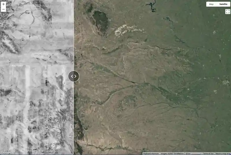
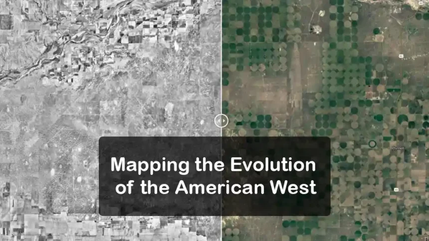
Discover the evolution of the American West with Landscape Explorer. Amapping tool that provides a unique view of the past 70 years. Accessible with just a web browser, the tool juxtaposes a modern Google map of the United States with a black-and-white aerial image from the 1950s. Using a slider button, users can effortlessly navigate between historical and current views, enabling them to witness transformations in specific locations.

A Tool for Understanding and Decision-Making
Beyond Historical Curiosity
Landscape Explorer serves not only as a tool for history enthusiasts but also plays a crucial role in aiding government agencies, landowners, and conservation professionals in making informed decisions about land management. Developed by Scott Morford, an applied spatial ecologist at the University of Montana, this tool is supported by Working Lands for Wildlife and other partners. It allows for a quick and comprehensive understanding of ecosystem changes, addressing the need for a universal and accessible resource.
Transforming Imagery with Technological Innovation
From Cold War Aerial Images to Modern Mosaics (American West)
To create Landscape Explorer, Morford and his team repurposed around 170,000 aerial images captured by U.S. Army aviators during the Cold War. These images, digitized and meticulously stitched together, form a continuous mosaic. The final integration with satellite imagery through Google Earth Engine enhances the tool’s effectiveness. By leveraging technology, the project revolutionizes the accessibility of large-scale historical imagery, previously limited to the 1980s.
Practical Applications and Future Prospects
Beyond Montana: Impact Across Western States
Initially conceived to assess woody encroachment in western Montana, Landscape Explorer has expanded its reach to 17 states in the West. Landowners, like Bruce Peterson, use the tool to address issues such as tree infiltration on family land. Conservation groups, such as the Southwest Montana Sagebrush Partnership and the Clark Fork Coalition, utilize it to prioritize restoration efforts and assess environmental impacts. As the tool gains traction, Morford anticipates its diverse applications, unlocking new ways to support land management and environmental conservation.


